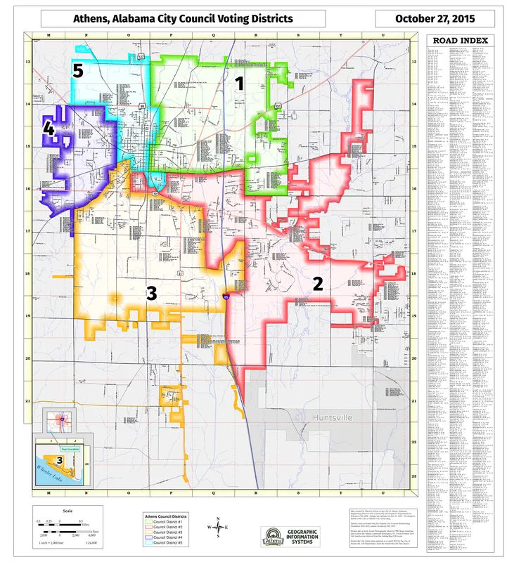
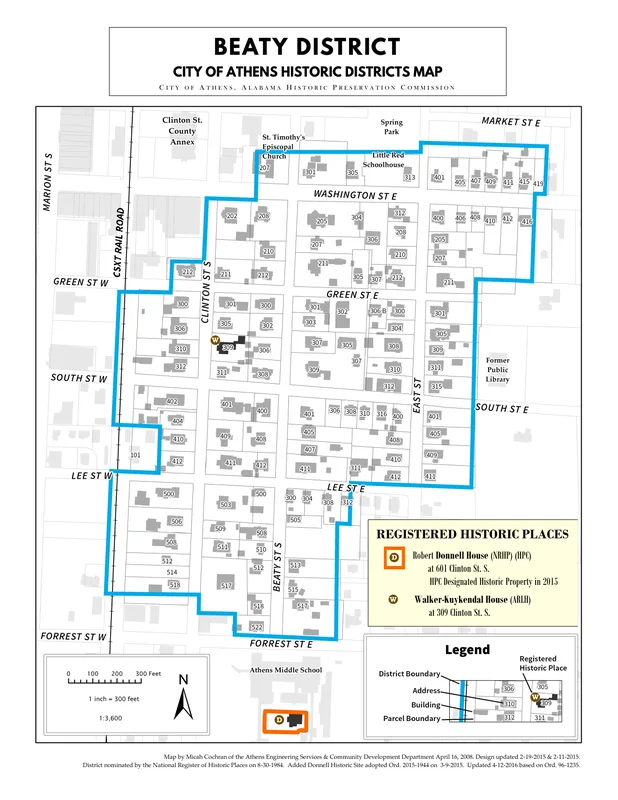
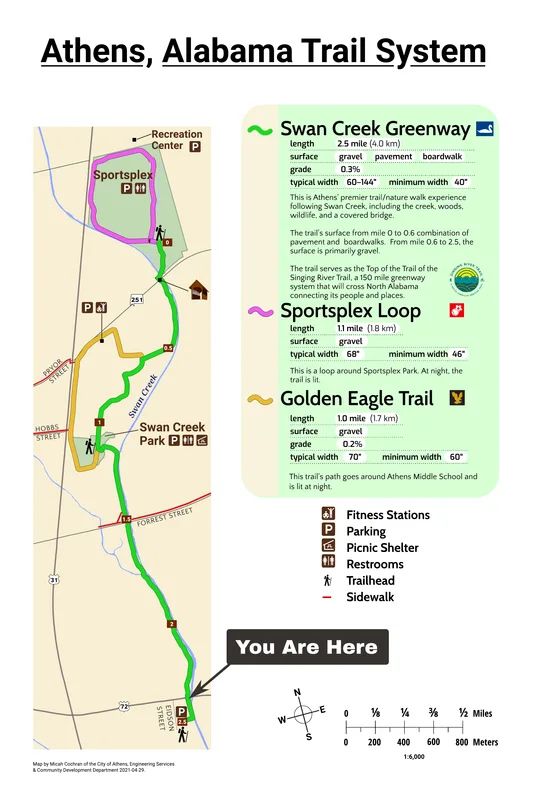
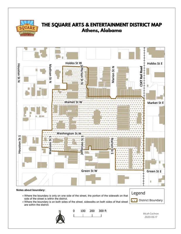
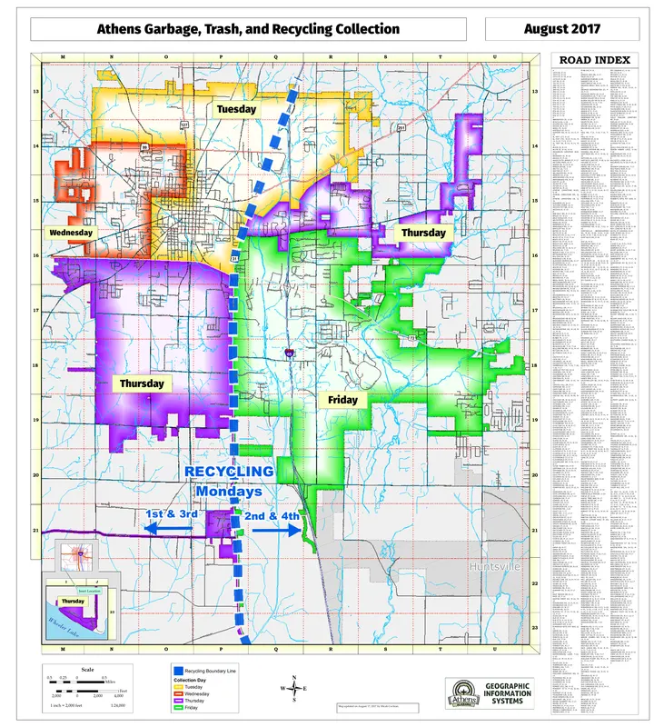
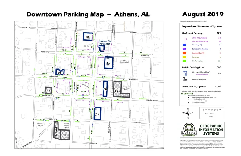
GIS Maps
GIS (Geographic Information Systems) duties include creating and maintaining geospatial databases. Cartographic techniques and graphic design were used to create well-designed maps. Below is a selection of the maps I have created.
(Note: Maps shows on this site are NOT official versions. Please refer to the City of Athens, Alabama Engineering Services and Community Development Department to inquire about the most current versions of these maps.)
Click on the map to view the original PDF version.
GIS — Feb 11, 2023
Search
Made with Hexo . Website's repo.